
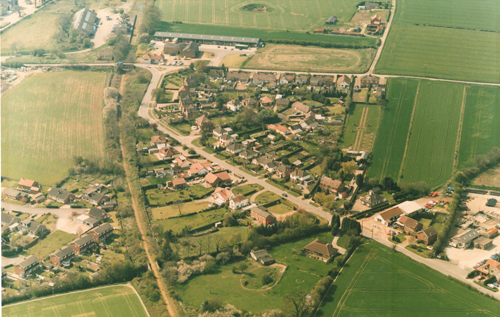
The August picture in the Reepham Life 2018 Calendar shows the Cawston Road/Wood Dalling junction as it was before the new houses were built on Crown Meadow.
On the site of the former Reepham Railway Station can be seen the old granary buildings (now Kerri’s Farmhouse Pine), the station building itself and the disused railway line leading down the view, which has become Marriott’s Way.
The group of small modern industrial units next to the station, known as Coller’s Way, was named after R. Coller & Son, coal and corn merchants, with the large older building (now Reepham Garage Services) still showing some old signs. Other businesses based at the yard were Stimpson & Hurn and William Freeston.
The bridge that took the road over the railway line is now a footpath. One of the highest points in Reepham, it was used as a lookout post by air raid wardens in the Second World War. Part of the original road still exists behind the wooded area as the road bends round towards Cawston.
Six roads met at what was once called Station Plain. However, the railway reduced it to five by making the Wood Dalling and Cawston Roads use the one bridge.
In the 1901 census this area near Reepham Station was still called Six Crossways. The main buildings here were The Crown Inn with a few surrounding cottages, one of which was a laundry business run by Matilda Timbers.
In the 1920s Philip Hunt opened a general supplies store and pork butcher’s, moving from a previous site in Reepham Moor. This later became Station Stores (now The Cutting Station hairdressers).
Janet Archer
The Reepham Archive is open to the public on the first Wednesday and Saturday of the month from 10 am – 12 noon (or by appointment), upstairs in the Bircham Centre, Market Place, Reepham. Email: reephamarchive@gmail.com
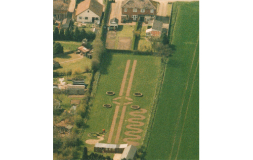
Does anyone know what and where these patterns were?